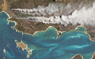
Can images from space help us achieve greener ways of growing food here on Earth? That’s the very real ambition behind precision agriculture, a new form of tech-driven farming which uses the data captured by satellites to help farmers grow more for less and maybe help make the food supply system more transparent in the process.
Agriculture doesn’t have a good reputation when it comes to sustainability. The constant drive to feed an ever-growing global population making it a major cause of deforestation and climate change. But satellite mapping, using satellite images to build a composite map of the Earth’s surface, now offers a vital source of information that is allowing farmers to better monitor their fields, manage their crops and ultimately improve yields and efficiency.
Satellite mapping is not a new technology. The first very blurry black and white satellite image of Earth was taken way back in 1959 by NASA’s Explorer 6, but in recent years the level of accuracy and breadth of coverage that the new breed of satellites can achieve has opened up a whole world of possibilities for satellite mapping.
“We’re capturing the entire earth’s landmass nearly every day at a resolution of about 3-5 metres per pixel,” explains Zara Khan, director of business development at Planet, a leading provider of geospatial data obtained via its constellation of around 200 active cubesat satellites.
“
It’s all connected, it just shows the ways that you can utilise this technology for different outcomes whether you are a grower, supplier, or a consumer.
Zara Khan, business development director, Planet
Agriculture has been quick to see the potential value of that level of high resolution, high coverage and high frequency data, offering as it does the chance to monitor a range of real-time factors such as growth rates, soil conditions, crop damage and water usage right down to an individual field level.
As a result, satellite mapping has become a valuable tool for agronomists and farmers looking to practice precision agriculture, the principle of applying a range of technological innovations like remote sensing, cloud computing and artificial intelligence to help farmers to grow more for less.
By having a better idea of what’s happening in a specific field, farmers can now make more informed decisions on the correct course of action, which in turn, can lead to more sustainable farming practices. Whether that’s more targeted application of fertiliser to reduce the risk of polluting run off, early identification of irrigation issues to decrease water wastage, or using satellite mapping to help plot the most efficient route for a combine harvester, this imagery when combined with other datasets and additional analytical tools can help optimise inputs.
While the potential is far-reaching — this data covers the entire Earth after all — the biggest challenge currently being faced by the industry is getting the relevant information to enough end users (the farmers) and getting it to them in a way that is accessible and actionable.
“
Satellite imagery can definitely help in terms of instilling greater transparency and credibility when it comes to the fields of sustainability and potentially carbon offsetting.
That’s where a raft of third-party companies and organisations are working hard to take that satellite imagery and curate the content to make it relevant to a specific end user, whether they are a smallholder farmer looking for anomalies in their rice crops in Indonesia, or an Australian dairy farmer looking to better manage his pasture.
“The other key challenge is making sure the information gets across that last mile,” states Khan, citing examples where partner companies have had to localise the language used or converted key data into a pdf format so it can be more easily shared via mobile phone.
Companies are not just looking at how to use the data in the short term, but also exploring how the huge archive of historical satellite imagery can be analysed to produce forecasts. This is becoming increasingly possible thanks to the development of powerful super computers which can use machine learning to study the patterns and trends from satellite imagery from the last 10 years. The aim is to be able to use these forecasts to make more accurate predictions relating to potential crop yields or flag up issues such as droughts or disease before they occur.
But satellite mapping doesn’t just have the potential to help growers farm more efficiently. With suppliers and consumers increasingly concerned with tracking where and how their food is grown there is also a potential for this data to play an important role in measuring issues around sustainability and best practice in the wider food supply chain.
Short of sending out inspectors to visit individual farms, it’s always been potentially difficult to check that farmers were really employing good practice when it came to how often they grazed their livestock or whether suppliers were really sourcing from farms that didn’t contribute to deforestation.
But by utilising the same satellite mapping data used in the growing process, there may be a quicker and easier way to monitor whether farmers are doing what they claim and actually meeting the relevant rules and regulations.
Dairy farmers in the United States are an early example of this in practice, utilising satellite data typically employed to track pasture management and biomass usage to demonstrate that their cattle are grazing outdoors for the required periods of time to meet US Department of Agriculture (USDA) organic certification standards.
“It’s all connected, it just shows the ways that you can utilise this technology for different outcomes whether you are a grower, supplier, or a consumer,” says Khan.
Looking ahead, satellite mapping’s ability to record broad areas of land relatively cheaply and quickly might make it invaluable when it comes to measuring the impact of carbon farming – the idea of improving the health of soil on farms to enable it to remove more carbon dioxide from the atmosphere.
While there has been some debate about the efficacy of this approach, carbon farming is clearly an opportunity that’s being actively pursued in the US, under the USDA’s incoming head Tom Vilsack, and as a key part of the European Union’s post-2020 Common Agricultural Policy (CAP).
“Satellite imagery can definitely help in terms of instilling greater transparency and credibility when it comes to the fields of sustainability and potentially carbon offsetting. We are partnering with academia and governments to develop the evidence base for measuring regenerative practices,” concludes Planet’s Khan. “Because without that trust you risk the whole system.”
Satellite mapping alone does not have the answers for a more sustainable agricultural future, but when combined with other technological innovations it does have the potential to help answer a lot of the challenges currently being faced by farmers, consumers, suppliers and governments.


