A constellation of tiny satellites in space could now be monitoring the daily movements of illegal loggers, and the health of acres of pristine rainforest.
In another continent, governments could be reviewing pictures of local farms to check if they planted cover crops during off seasons to keep soil carbon emissions down.
It’s a level of monitoring that until recent years was but a dream for public agencies, researchers and conservation groups, as environmental damage continued around them, seemingly immune to stronger laws and boots on the ground.
But commercial satellite imaging is now a US$2.6 billion industry that is set to grow almost three-fold by the end of the decade, according to analytics firm Allied Market Research. Orbital launches are becoming an increasingly accessible private venture, as aerospace firms shrink satellite payloads to the size of shoeboxes, allowing them to be deployed in swarms.
Such firms now share the space with huge public agencies like the United States’ National Aeronautics and Space Administration (NASA) and Europe’s multilateral space agency ESA, which once was the sole custodian of spacefaring.
The rapid advancement of satellite imaging technology could provide better data and more ammunition for environmental defenders to go after culprits. But not everyone can afford to buy satellite pictures — especially not the poorest, who may be the hardest hit by climate change.
Eco-Business spoke about these issues with Kevin Weil, president of product and business at Planet, a firm that has sent over 200 small satellites into space to photograph almost the entire world once a day.

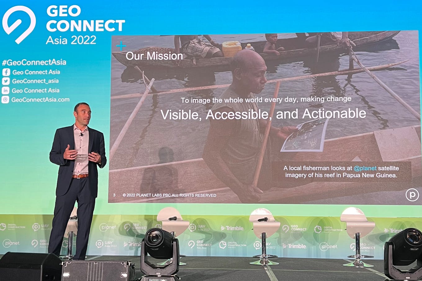
Kevin Weil, president of product and business at Planet, speaking at Geo Connect Asia, a trade conference in Singapore. Image: Planet Labs PBC.
What are some of the new uses of satellite imagery in the fields of sustainability and climate change?
Fundamentally, it is about ground truth, about how the world is evolving. It is applicable to a whole bunch of different industries.
You can think about agriculture, where a farmer used to be walking in his fields to understand how the crops were growing or where there was blight. Now we can do that automatically through satellites. We can do it not just for one field, but for every field across the whole world.
Europe has the Common Agricultural Policy, that is incentivising farmers to grow crops more sustainably, through practices like cover cropping. A lot of European countries are using Planet’s data to automatically verify that farmers are following these sustainable best practices. Governments are automatically paying farms based on our data.
We also have machine learning and artificial intelligence algorithms that identify where roads and buildings are being built, to ensure that they are being built in a sustainable way.
Our technology can even be applied in the world of finance. We have forged a relationship with Moody’s, where they use our data to help them measure Environmental, Social, and Governance (ESG) best practices for financial institutions and businesses around the world.
Do you have examples of when Planet’s satellite imagery has been used to successfully fight deforestation?
We work with Norway’s International Climate and Forest Initiative (NICFI) to provide a dataset of the world’s tropical forests as a digital public good, free for researchers around the world. It covers basically every tropical forest in the world between 30 and negative 30 degrees of latitude.
This programme is now issuing 10 times the number of citations for illegal deforestation than they were previously.
It is incredible what people are doing with the data. We also have a partnership with Mapbiomas, which is using the data and working with governments to penalise people who are deforesting illegally.
One more thing that is really cool – in Brazil’s rainforests, deforestation is frequently caused by narcotics traffickers. They will build roads deep into the Amazon, and then they’ll clear a runway to transport drugs. If you can catch the deforestation as it begins, you can intercede and stop both deforestation and drug trafficking.
A common lament about climate mitigation is that not enough is being done. How does better satellite imagery help address this?
There is the common saying that you cannot manage what you cannot measure. Our satellite imagery gives people daily data about the Earth and how it is changing. That is the first step.
The data also creates a shared accountability. We are part of the Allen Coral Atlas, where we use our data to map corals everywhere in the world, including the type of corals on a reef. Having done that, about 10 companies have protected their marine coral areas since.
It is not that these companies didn’t know they had corals in their space, but that now everyone else knew they are there, so suddenly there was accountability and the pressure to act. Even just having this data out there leads to action.
How do you ensure that the satellite imagery you provide does not help to boost surveying and exploitation of Earth’s natural resources instead?
The answer is largely the same – we create transparency and shared accountability. If someone were to use our data for something that runs counter to making our world a more sustainable place, we are hoping to make that visible. As the world increasingly values sustainability, people are going to push back and help us more in a positive direction.
How do you balance providing quicker, more regular and higher resolution satellite imagery with the privacy rights of landowners?
Our smallest satellites have a resolution of about three metres per pixel. That means a square three metres each side turns into a pixel. You and I are much smaller than a three-metre square. So we cannot identify humans, nor license plates or newspapers. A lot of these privacy issues don’t come up as a result.
There are physical limits to how granular you can get from space, and I think aerial imagery and drone imagery run into privacy issues quicker than satellites.
How do you decide what satellite imagery to release as free open-source data, and what you monetise?
A lot of times it has to do with the latency of the data. For NICFI, we are providing monthly maps. In June, you might get maps from May. A 30-day delay is still perfect for research and learning. We build our business around companies and governments that need access to real-time data.
We love offering our data as public good, we believe it benefits researchers around the world, and that benefits people around the world. We had something like two peer-reviewed papers published every day citing Planet data in 2021. Now there are over 2,000 papers in total.
In these instances, we generally work with partners pro bono, we just look to cover our costs. NASA, for example, has sponsored our data to put it in the hands of researchers and graduate students all over the United States.
We are a public company, and a Public Benefit Corporation. Our responsibility is both to shareholders and our public benefit statement, to “accelerate humanity toward a more sustainable, secure, and prosperous world, by illuminating environmental and social change”.
We have to build a business, obviously, so that we can be around to achieve the mission. But I think we have found a good balance.

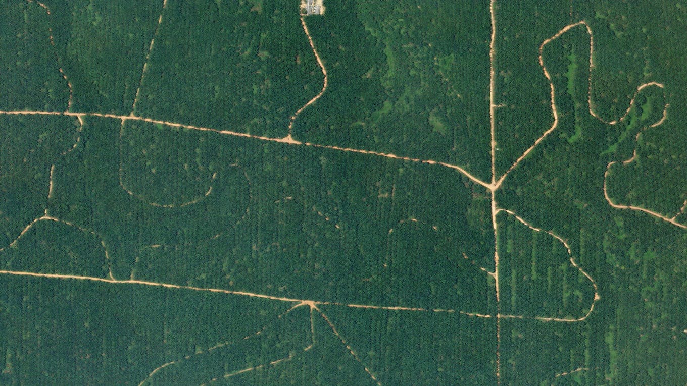
Palm oil plantation in Sumatra, Indonesia. Image: Planet Labs PBC.
Small farmers operating off the grid in Asia are often the worst affected by climate change. How do you ensure that your products benefit them?
Smallholder farmers’ fields are often narrow, and to help them understand what is going on, you need higher resolution imagery.
This is where some of the public data we issue come into play. For example, Indonesia is a member of NIFCI. So you have researchers and local governments in Indonesia who are able to access this data, study it and provide value to smallholder farms.
Commercially, we work with some of the biggest agricultural companies in the world, who themselves have those farmers as clients. So they take our data and use it to provide information, through perhaps farmers’ mobile phones, for them to understand how their crops are doing. So there are multiple ways in which those farmers can benefit from our data.
We can’t solve every problem directly, and we know that our data is going to have more impact if we can work with a network of partners all over the world, who can then build products that directly address what their customers need.
Satellite imagery has traditionally been provided as a public good by government agencies, such as NASA and ESA. How do you see the relationship between public agencies and the private space sector evolving as the private sector grows?
The relationship is really strong. We work closely with NASA, ESA and many other space institutions around the world.
I think increasingly, government organisations are realising the value of commercial satellite constellations. They can learn a lot from it, benefit from the data, and it means they don’t have to spend their money doing something that the commercial industry is already doing. They can spend their money doing things that are not yet commercially feasible, such as new sensors and new experiments, and the commercial side learns from those trials.
It is not a zero-sum game. We use data from NASA and ESA satellites where their data is better, for example, in finer calibration. We use that to improve our satellites’ data, and ultimately offer a better product to customers and researchers. There is an exchange of value going in both directions.
What are the next big things Planet is working on?
We are working on two new constellations of satellites. One is called Pelican, an updated version of our high-res satellites. When it is launched, we expect that it will be able to do 30-centimetre resolution imagery, and offer data faster.
You are not going to be able to identify a person still at that resolution, with the satellite 325 kilometres above the Earth. We won’t be the first people to have a 30-centimetre resolution satellite, so we have an opportunity to learn from the folks who have gone before us.
We are building the other constellation to measure well into the electromagnetic spectrum that humans cannot see, to detect, for example, carbon dioxide and methane point sources. It will be able to detect pipeline leaks, and measure biodiversity in new and interesting ways.
On the software front, we are using artificial intelligence and machine learning to help extract insights, highlight changes, notify people of anomalies.
What strikes you the most when you look at satellite images of the Earth?
You don’t see borders, not country borders, not state borders. You just see the world. It is a reminder that we all share this one planet together.
You also see such variety around the world – beautiful landscapes that you could not have imagined. It drives home the point that we have this one planet to protect and preserve.
This interview has been edited for clarity and brevity.


