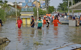
Some Asian cities may see over a 30 per cent increase in the population at risk of extreme flooding by 2020, according to leading UK-based catastrophe modelling company JBA Risk Management Limited (JBA RML).
Original research undertaken by JBA RML in their Flood in Focus bulletin highlights how the Asia Pacific (APAC) region, with 26 countries, has more than half of the world’s total population.
The study draws attention to the extreme flood risk potential within several of the world’s most populous cities and rapidly emerging insurance markets.
Given that several of these cities lie next to major river systems, prone to severe flooding, JBA Risk Management has assessed the potential impacts such extreme flooding poses to future populations.
The study’s author, JBA technical director Dr Iain Willis, said on Monday: “This research shows that large conurbations in Asia continue to be at substantial risk of flood damage. It also shows that in the next five years at least, we could reasonably expect this risk to increase based on projected population levels.”
“A lot of this increase is driven purely by socio-economic changes, such as rural-urban migration within APAC countries.”
“I think these findings help reaffirm the importance of flood modelling in the region. The continued rise of non-life and life insurance in the next few years across APAC is backed up by a burgeoning middle class that see insurance as an increasingly important part of their risk management, whether for their families or businesses.”
The analysis focused on four major Asian cities: Jakarta, Bangkok, Manila, and Singapore. JBA’s high resolution global flood maps (GFM®) were compared to gridded population density projections to estimate the exposed population in both 2010 and 2020.
The findings highlight that significant population increases are projected for all the cities in the study and that the number of people exposed to extreme river and surface water flooding could increase by over 30 per cent by 2020.
When compared to the JBA river flood maps for a 1/200 year return period, Bangkok and Jakarta show population exposures of 5.3 million and 5.2 million.
This would represent a 36 per cent and 33 per cent rise from 2010 levels respectively. Manila could see increases of around 27 per cent, whilst Singapore was 17 per cent.
The methodology made use of UN projected population data from the Worldpop project (www.worldpop.org.uk) that provides high resolution density maps for future projected years.
Using a Geographical Information System (GIS), the JBA River and Surface water hazard maps were compared to the population projections, together with city boundaries to determine cumulative populations at risk in different years.
With total gross premium increases in APAC averaging 6.6 per cent annually from 2002-2014, these findings further highlight the growing insured flood risk exposure in the region and the continued challenges this poses for risk management.
The study is available here.


